Markt Pfoerring:Water Management / Groundwater Simulation, Danube River
Disciplines
-
 GIS – Geographical Information Systems
-
 Hydraulic Engineering
Companies
Dorsch Engineers
Client
Wasserwirtschaftsamt Ingolstadt
Duration
From 2004 to 2005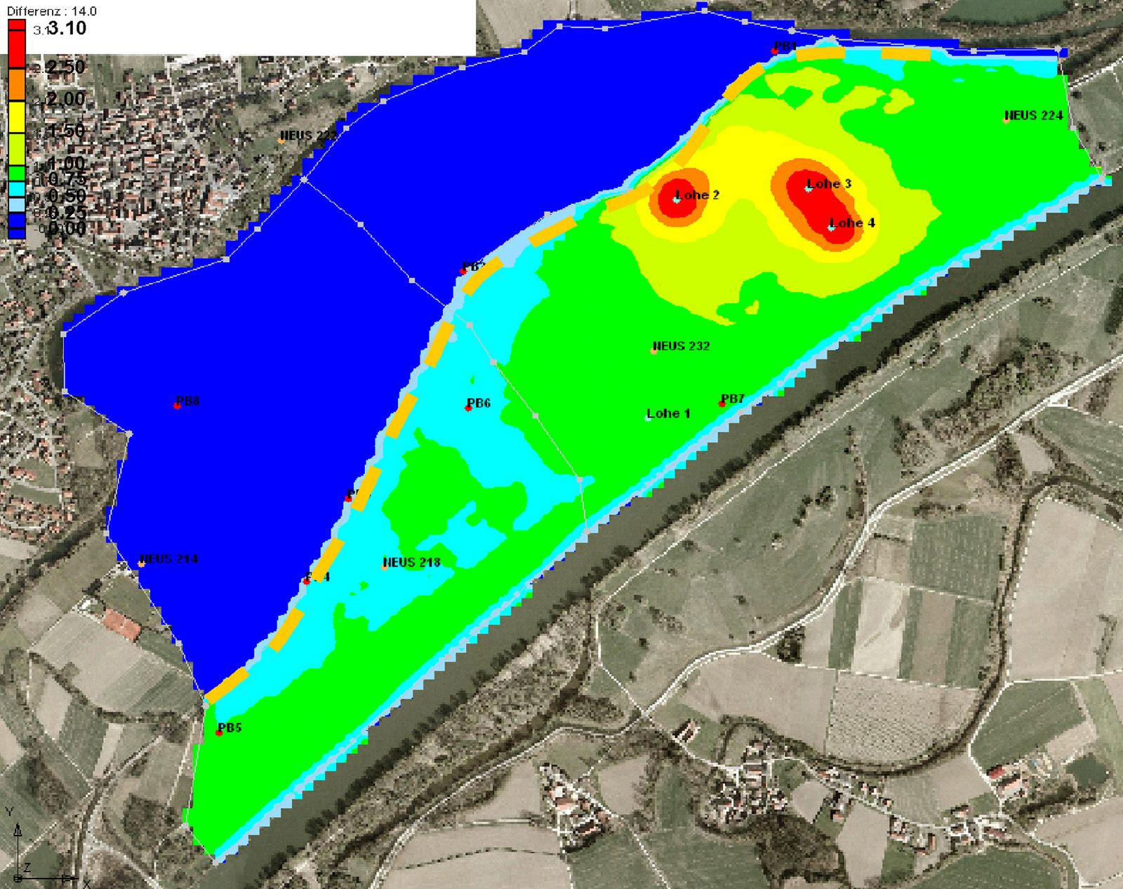
Project Activities
- Determination of basic conditions and boundary conditions
- Drilling profiles
- Developing a groundwater model for the as-is state including a calibration of model parameters
- Simulation of the forecast state including different scenarios
- Postprocessing: Displaying results as difference maps and contour plots
Contact
Dorsch Engineers GmbH
München (Headquarters)
80687 München
Germany
Phone: +49 89 5797-0
Fax: +49 89 5797-800
E-Mail: info@dorsch.de
Description
In order to analyze the impact on the groundwater levels due to relocating a dam, which currently is located along the Danube river, a groundwater model is developed.
The additional retention area can be used as a preventive and decentralised flood retention.
Based on given geological, hydro-geological, and topographical data combined with initiated groundwater measurements, a three-dimensional transient groundwater model is developed.
The model includes the entire investigation domain, the boundary conditions, a 3-dimensional digital surface model and the model parameters such as conductivity and porosity.
The model parameters have been calibrated.
The infiltration of surface water through the different im- permeable surface layers into the soil is modelled by a leakage approach which also has been calibrated.